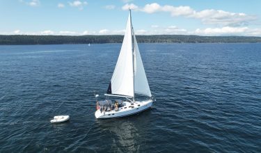
 Whether you are going to sailing school here on Vancouver island or wherever you may be learning to sail, basic navigation is a fundamental skill that all sailors need to acquire.
Learning how to navigate a boat either using traditional paper charts or a chartplotter or charting app, is something that a sailing school will definitely be teaching you depending on the course you take, as it critical to know how to reach your intended destination safely and efficiently avoiding any underwater obstructions and guiding you safely through even well known waters. Many boats have been lost due to poor navigation, even with modern electronics that most sailors now take for granted, therefore basic navigation is an essential sailing school skill to learn!
There are two fundamental sides to navigation;
1. To know exactly where you are at any given moment
2. Knowing which way to go in order to best reach your intended destination.
Understanding the traditional methods used is very helpful in case modern electronics fail you at a critical point.
Using Paper Charts for navigation
It is best to always have on board and know how to read the traditional paper charts, even if you are also using a GPS enabled chartplotter or apps.
The charts should always be the most recent published if possible and in an appropriate scale. It is now possible to download the latest paper charts and print them yourself.
Know where you are!
 You need to maintain a sense of your position by taking in around you any aids to navigation, such as local landmarks, coloured buoys, lighthouses or lighted buoys, and taking compass bearings to shore features.
So for example, observe a small island at 270 degrees and a lighthouse at 40 degrees, then use parallel rules lined up with the correct angles on the compass rose on the chart. Then pencil in the bearing lines back from these features and where these lines cross is your approximate position. To be even more accurate then you could take three lines of bearings.
Know which way to go!
 To then plot your course from your current position to the destination that you want to reach, and taking into consideration any waypoints that you need to avoid or turn towards (such as a rocky headland for example). Firstly using the parallel rules, walk the line over to the compass rose in order to determine which direction to steer your boat. Then you can use chart dividers to measure the approximate distance to that point. You can also determine your boat’s speed in order to work how the approx time taken to reach your destination or waypoint. Then it is a good idea to continue to take bearings in order to make sure your changing position correlates to the course you have plotted on the chart.
Be aware of currents that can sweep you off course, as well as the fact that the boat will side slip downwind slightly as well.
Using Chartplotters and Charting Apps
If you are using chartplotters or navigational charting apps to aid in your sailing boat’s navigation then this is a great way of making it easy to see where you are, as an app can superimpose your position on the chart on the screen. Then you can use line of sight to head for your destination or plot the waypoints into the app which will then, in effect, build a route for you, so you then follow the line on the chart screen and steer along it.
However, there is no substitute for being able to plot your position manually as well, as you can go off course fairly easily because of currents or steering slightly off course. So these aids definitely have their place in the sailing school of navigation, but using both cautiously and plotting route lines into your charting app, gives you the best chance of safe passage to your destination.
And finally…
There are of course others methods of navigation used by sailors over hundreds or years, such as estimating boat speeds by watching the motion of the water on nearby points or the hull of your boat. Using the boat’s depthfinder is another way, by comparing the measured depth onboard to the depth on the chart. Or of course celestial navigation, by using a sextant and calculating your position with the stars is a very traditional method of navigation.